Record warmth possible through Saturday across Charlotte region as heat wave continues
Cold front arrives Sunday
CHARLOTTE, N.C. (WBTV) - As the summer-like heat continues, we can expect chances for more record-breaking warmth through the first half of the weekend.
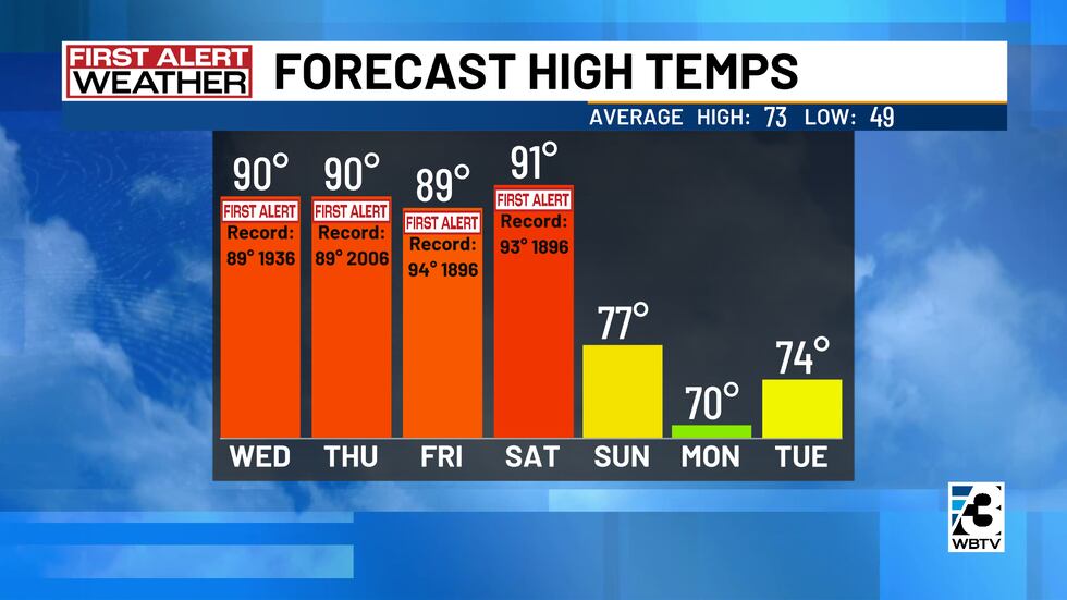
High pressure over the southeast will continue to keep hot and dry conditions in the forecast for the balance of today and through Friday. We will wrap up Thursday afternoon with plenty of sunshine and highs in the upper 80s and lower 90s.
Wednesday night will be mostly clear, mild, and dry with lows in the 50s and 60s. Highs on Thursday and Friday will be unseasonably warm in the upper 80s and lower 90s under mostly sunny skies.
Cold front this weekend
This weekend, a cold front will head towards the Carolinas, finally bringing relief from the heat. Saturday is on track to be the last day of our heat wave, with a mix of sunshine and clouds and highs in the upper 80s and lower 90s.
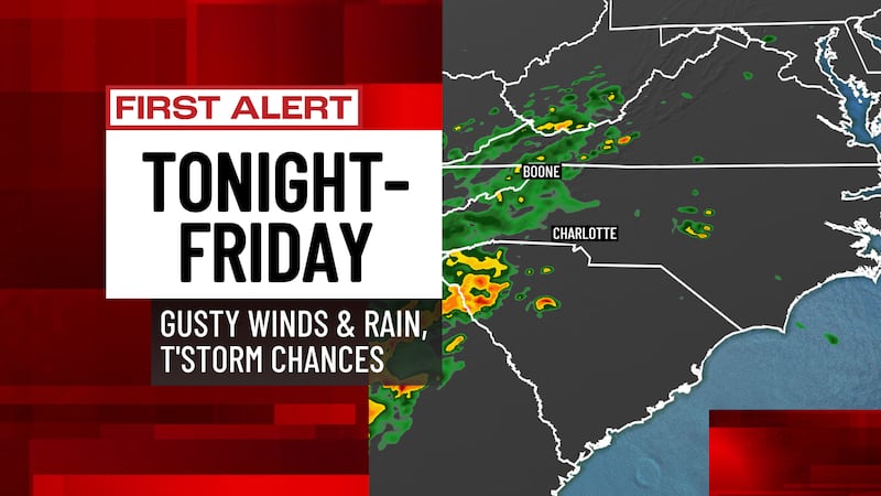
Expect some hit-or-miss showers on Sunday and significantly cooler high temperatures in the upper 70s. Cooler temperatures will continue into early next week, along with minimal rain chances.
Forecast at a glance
- First Alert Wednesday: Very warm, mostly sunny
- First Alert Thursday: Mainly sunny, hot, record-warmth possible
- First Alert Friday: Mostly sunny, very warm
Download the free WBTV Weather app on your mobile device to receive weather alerts and to get the latest forecast on the go. You can also catch the latest forecast on WBTV’s streaming app -- find it in the app store on your smart TV or streaming device.
Copyright 2026 WBTV. All rights reserved.